Newbattle
A new landscape structure informed by centuries old field patterns, estate plantations and mass/void, is integrated into an existing Historic Garden Landscape.
- Year
- 2013
- Location
- Newtongrange
- Category
- Masterplanning
Landscape Setting
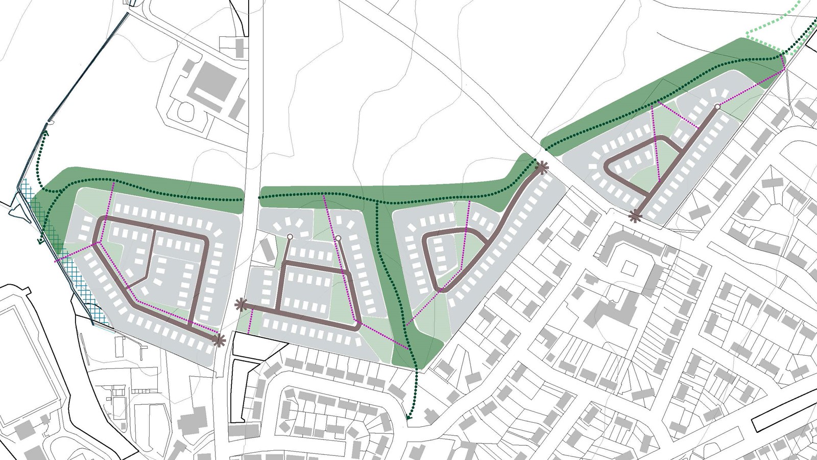
An indicative masterplan on a 11.3 Ha site. Good design practice has been guiding the proposals with integrated landscape, streets and housing creating a desirable place to live. The scale of the development has been accommodated within the existing landscape structure redefined by this proposal. A hierarchy of open space and streets work together to create unique places and define a sense of place within the existing character of the village.
Urban Expansion
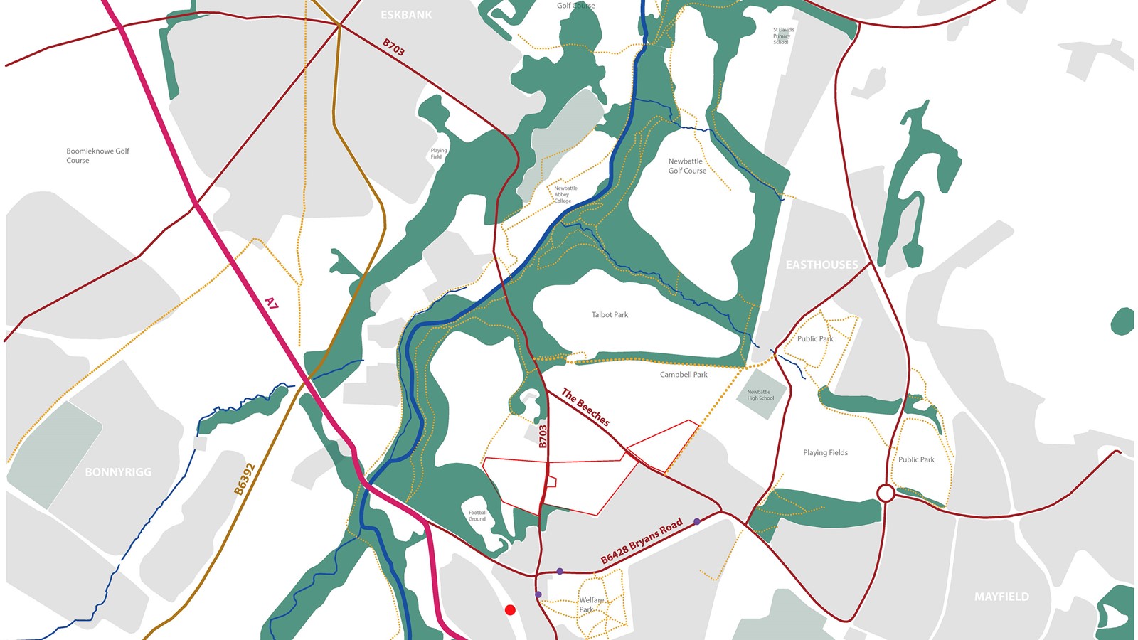
Newtongrange is located approximately 9.0miles south of Edinburgh City Centre. Within easy access of the A720, Edinburgh Bypass, off the A7.
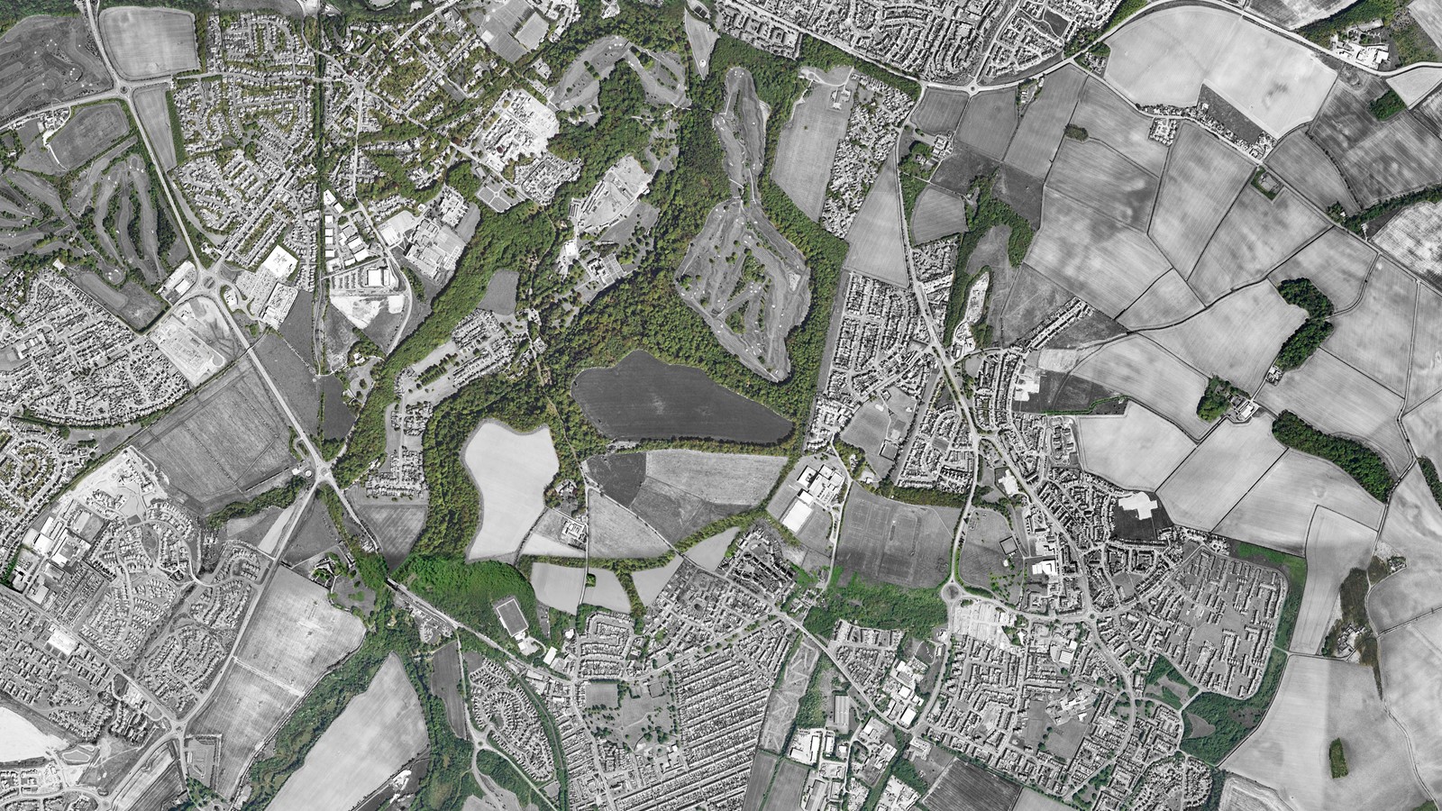
An area to the north of the village of Newtongrange and to the south of Newbattle village. The proposed sites fall within the A7/ A68/ Borders Rail Corridor and has potential access off the main routes into the village. The Newbattle Abbey Historic Gardens and Designed Landscape designation is adjacent. The study sets out a case for including small scale development within this area.
The River South Esk runs from the south west to the north east approximately 500m from the sites.
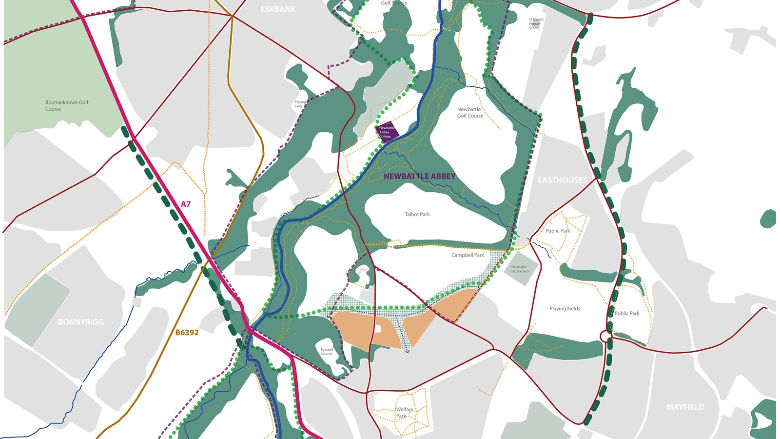
Strategic Greenspace
The Midlothian Council proposal for a strategic greenspace falls to the north of the sites and is an opportunity to engage with and encourage pedestrian permeability and cycleways into the greenspace. Networks of paths run through the woods, surrounding the site to the south, and along the side of fields providing recreational connections into the countryside.
The site is considered suitable for development for the following reasons: potential to be well contained development within existing and reinforced landscape structure; gentle slopes, overall; the site is out with the green belt; there are good public transport links; and there are potential links and available access to the countryside connecting to existing cycle and walking networks. A hierarchy of open space and streets work together to create unique places and define a sense of place within the existing character of the village.
A new northern boundary for the village has been created. A new defensible edge to development and a ‘bridge’ between the village and the countryside. The development is of a scale which can be accommodated within the village of circa 5000 population.

Historic Gardens and Designed Landscapes
In 2001 Newbattle Abbey and its grounds were included in the Historic Scotland inventory of Historic Gardens and Designed Landscapes. It is considered a site of national importance with a multi period landscape of early monastic, formal 16th century landscape, and picturesque, romantic landscapes of the 19th Century. The design and estate landscape is a major influence on the rural landscape and its settlement character.
Newbattle is of outstanding historic value dating back from 12th Century. The main value and characteristic of the estate are the rides and paths through the mature woodlands, a woodland structure which defines a series of parks, such as Talbot and Campbell park, which are generally laid to livestock grazing or arable farmland. It is this pattern of mass and void, rides and parks which has heavily influenced our approach to the proposed landscape framework.
The extensive policies have considerably influenced modern landscape development with shelterbelts, parkland trees and neat stone walls which define the farmland slopes. The perimeter belts and woodland planting delineate the individual parkland enclosures form a distinctive landscape character which has influenced the landscape and development beyond the estate.