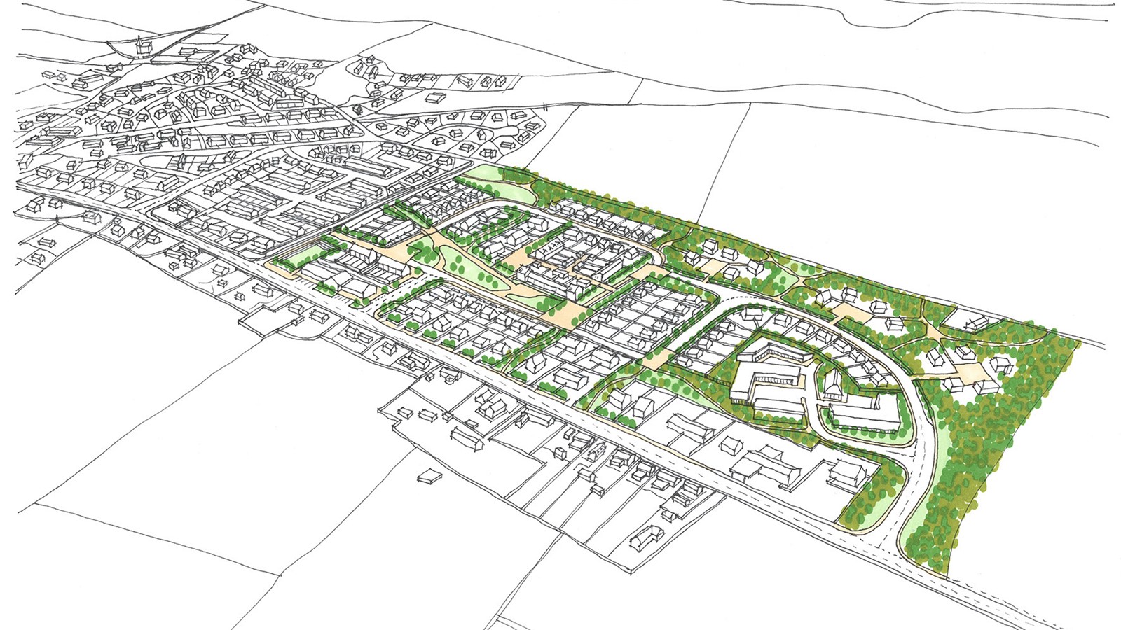
St.Cyrus, Aberdeenshire
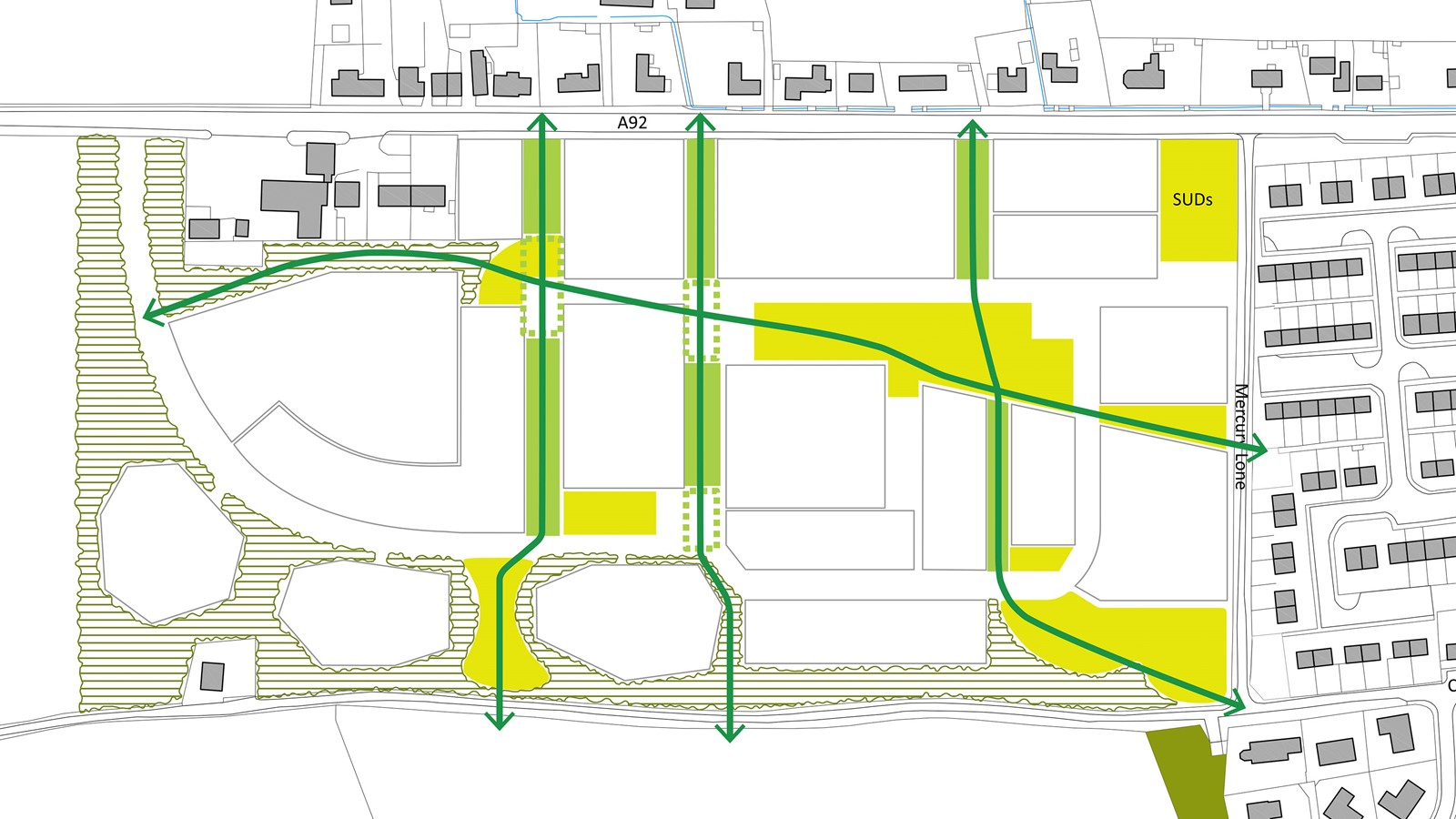
A network of green/blue corridors structure the proposals, drawing the existing village into the heart of the neighbourhood. A sensitive approach integrated into the fabric of the village.
- Year
- 2013
- Location
- St.Cyrus
- Category
- Masterplanning
Connectivity, Structure and Focus
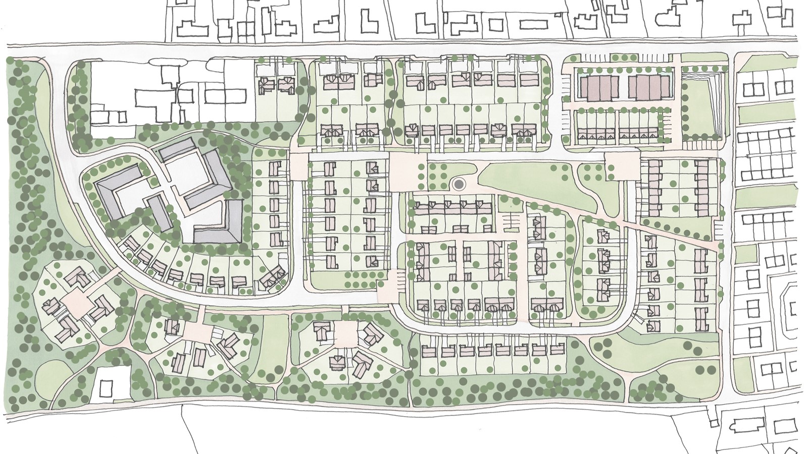
The concept approach for the development is to provide a focus to the community, offering a new civic heart. A central community green located on the area provides a focus for the new development.
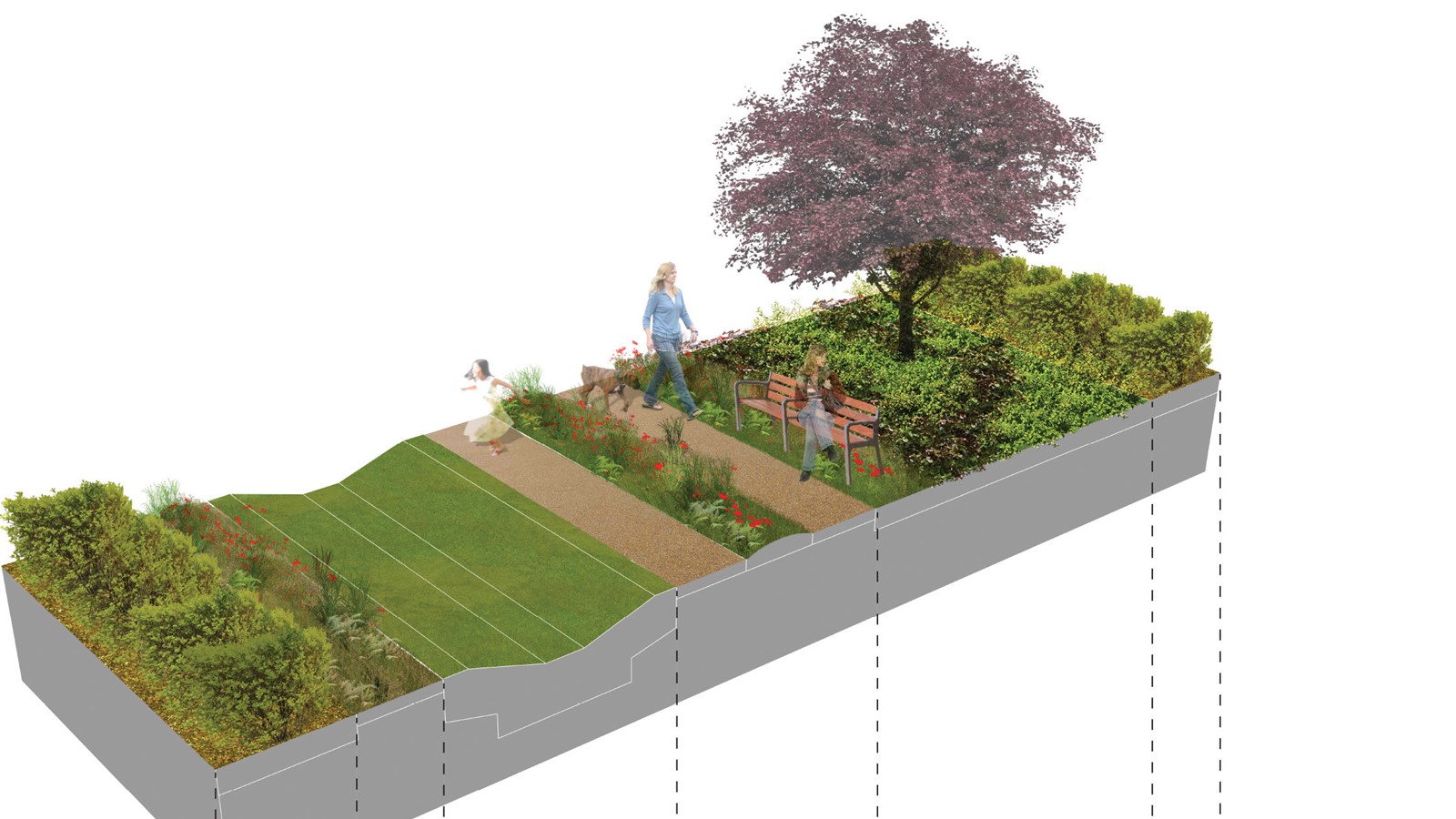
Blue/Green corridors provide recreation routes through the development breaking up the housing into smaller scale clusters more in keeping with the scale of the existing village housing areas. The three key principles of the concept are: connectivity; landscape structure; and a new focus.
The three key principles of the Masterplan concept are; connectivity; landscape structure; and a new focus.
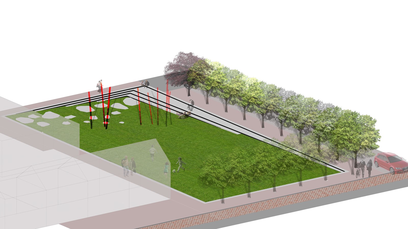
Open Space Benefits
The key objectives which this Masterplan seeks to deliver for St Cyrus are; to create a sensitive development; offer connections through the development in which wildlife and flora are encouraged into the heart of the development; provide high quality public spaces to benefit not just the new development but the village as a whole; provide opportunities for work/live through a designated employment opportunity; integrate surface water systems into the landscape and create new amenity through considerate design; and provide a landscape structure of native trees and woodland to define open spaces and streetscapes.
St.Cyrus Village
The village of St Cyrus lies midway between Inverbervie and Montrose on the A92, approximately 18 miles from Stonehaven, 7 miles from Inverberive and 5 miles from Montrose. The current population is 1,071 from the 2011 Census. The Masterplan site comprises approximately 10.1 ha (25 acres) of land in agricultural use and adjoins Mercury Loan to the south-west of St Cyrus. The A92 runs along the northern site boundary,
The primary contextual issues including the built and natural environment, climate, transport, ecology and the infrastructure have each informed the development of the Masterplan.
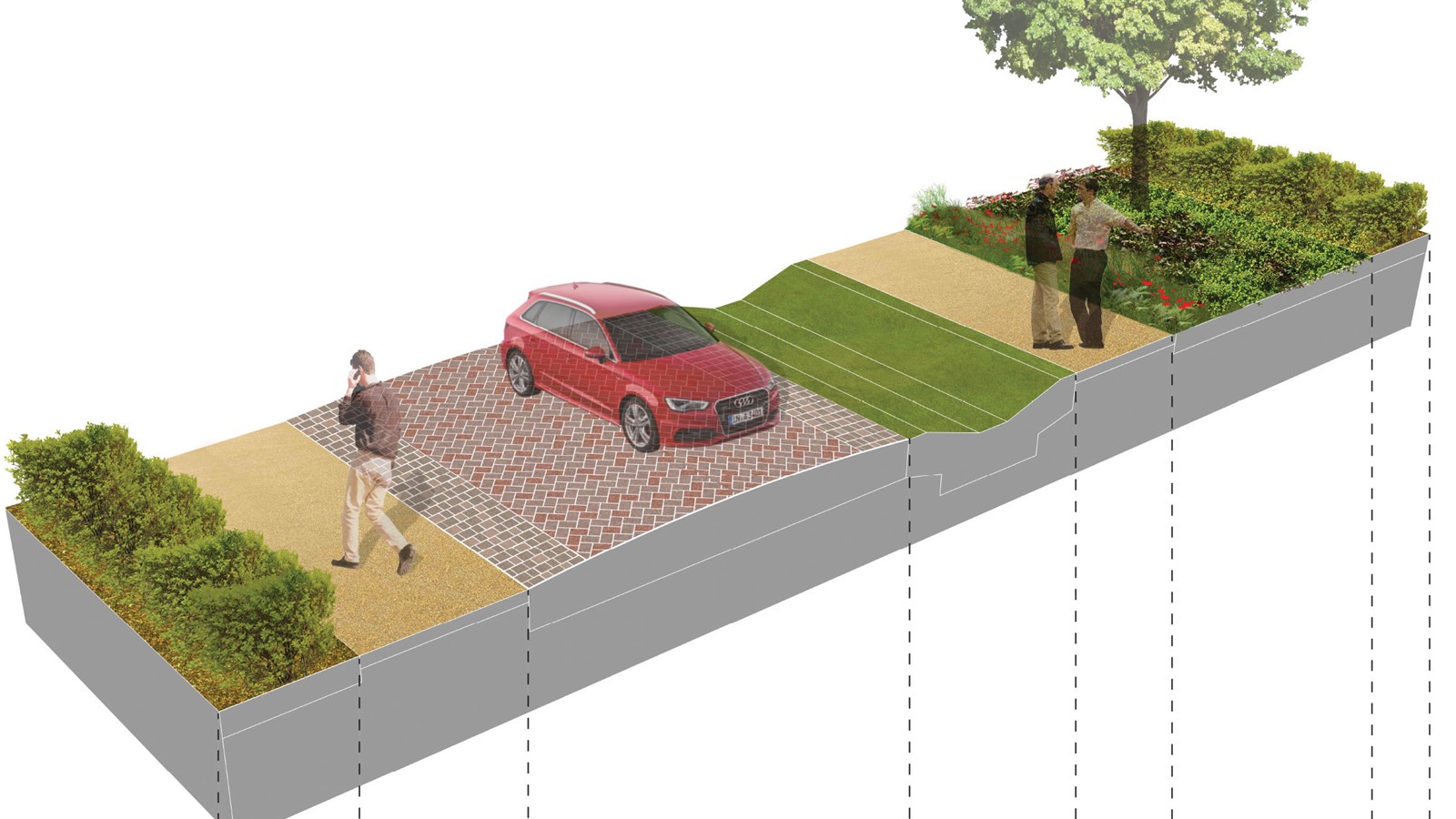
Green/Blue Corridors
The masterplan sets out proposals for a sustainable community of 125 new homes, employment and retail opportunities and high quality streetscape and open spaces. The new development at St. Cyrus responds to the unique character and setting of the village. The development offers the village a new focus and centre.
The development is of a sensitive scale and form which enhances the character of the village. The Masterplan establishes a deliverable vision which is unique to the village, respects the character of the local area and identifies infrastructure requirements and mitigation to allow for phased development of the site.
Open space throughout the development is designed as an integral element of the Masterplan, they have a purpose and function, they are centrally located and overlooked by adjacent houses. The existing open spaces adjoining the property will be part of the site landscape strategy connecting the new proposals with the existing buildings and village.
The overall vision for the Landscape Strategy is to:
“provide high quality multi-functional open space that is easily accessible, safe, welcoming, rich in biodiversity and sustainably managed for the future; which encourages a sense of belonging, and enhances the quality of life of those people who live, work in and visit St Cyrus”.
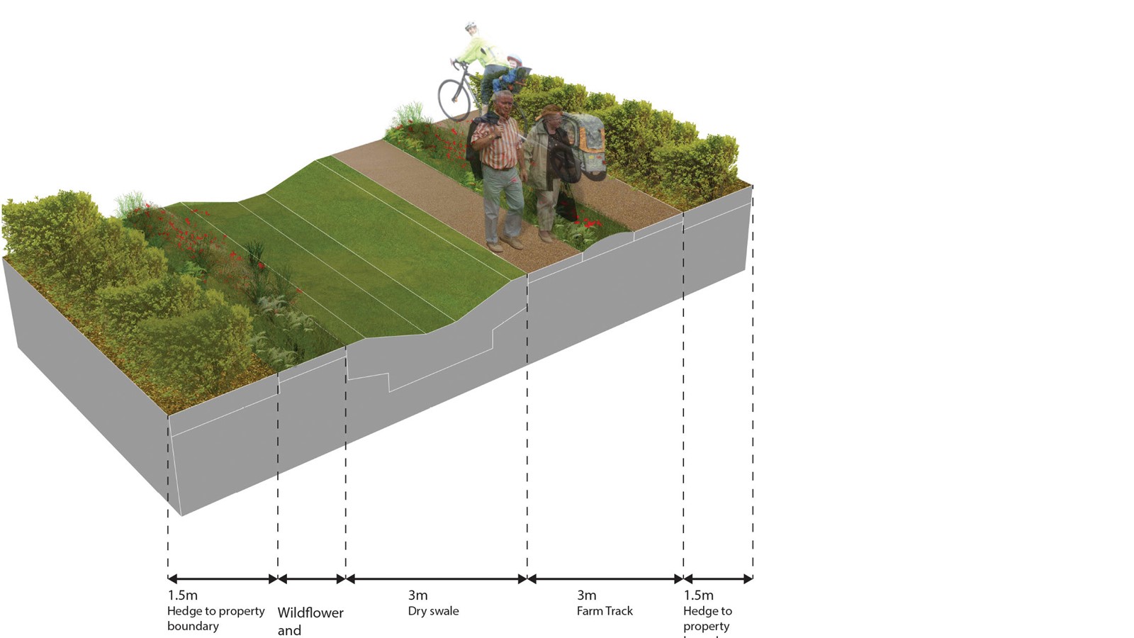
Landscape Framework
Fundamental to the masterplan proposals is a strong landscape framework which is informed by the local landscape character, views, connectivity and the functional response to surface water through a network of integrated drainage solutions. Native planting throughout the site improves biodiversity and the surface water runoff from roads, roofs and garden areas is directed into a network of shallow ditches (swales), these features are integrated into the landscape structure. The landscape greenways increase permeability through the development and become linear parkways.